

You thought our roads were busy - here is a screen shot from the A.I.S. (Automatic Information System) plot at lunch time today and shows vessels in the English Channel. Ships carry a transponder which gives out a low power VHF transmission every minute and shows COG, SOG, destination port & can also be tracked from where it's been.
Green is General Cargo, Blue is Passenger, Yellow are high speed craft, grey are "Special Purpose" including military and purple are private craft which is not mandatory to carry the transponders as it is for commercials.
What I found especially interesting is that red icons are tankers transporting oil & gas. There's an absolute shedload of them.
Even though I have been a lifelong boater and have been across the channel in all kinds of craft, this plot really surprised me and is a microcosm of the amount of trade we do day in day out. This plot will be just as busy at midnight so spare a thought for all the mariners out there on the marine equivalent of a super highway!
The Channel Separation Zone can clearly be seen: Westbound British side, Eastbound French side. Crossing can only be done at right angles - oblique angles are not permitted. It looks crazy - but it works! Collisions are few...
The ships depicted here range in size from a few thousand tonnes to over 200,000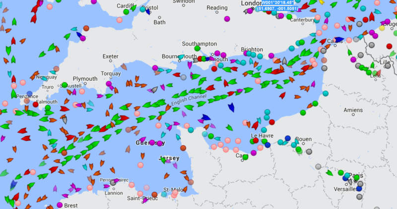

Last edited: